Another hurricane targeting FL - Milton

GunnyGene

Hawkeye
Joined
Nov 23, 2013
Messages
14,393
City & State/Province
Monroe County, MS
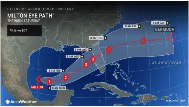
Coming out of the Gulf and aimed at Tampa. Forecast will hit at Cat 3 on Wed.

https://www.accuweather.com/en/hurr...-a-major-hurricane-and-target-florida/1699524
milton.jpg
 
Looks like it could go right over Ocala where we have a good friend. She lives in a trailer. I hoe the tress in the forest make enough of a wind break becuase she aint leaving.
 
At a CAT three or above anywhere along the path is going to be rough. As it crosses the state the forward edge will be over the Atlantic to keep it strong.
 
As an Amazon Associate we earn from qualifying purchases. Product prices and availability are accurate as of the date/time indicated and are subject to change.
GET TOILET PAPER!!! :)

I'm in southeast Florida since 1977 and have been blessed to not have had any issues from canes.

Fingers crossed.
 
Let's start an unsubstantiated theory.

This is a prelude to a catastrophic Polar Shift.
No, it's a prelude to the Tribulation, and then the Second Coming...We've already had a "polar shift", hence the earth's tilt and the fact that north ain't really north. That happened back in the Old Testament day's....You know, that time that the Lord caused the sun dial to back up as a sign.

DGW
 
This is unfathomable!
🚨
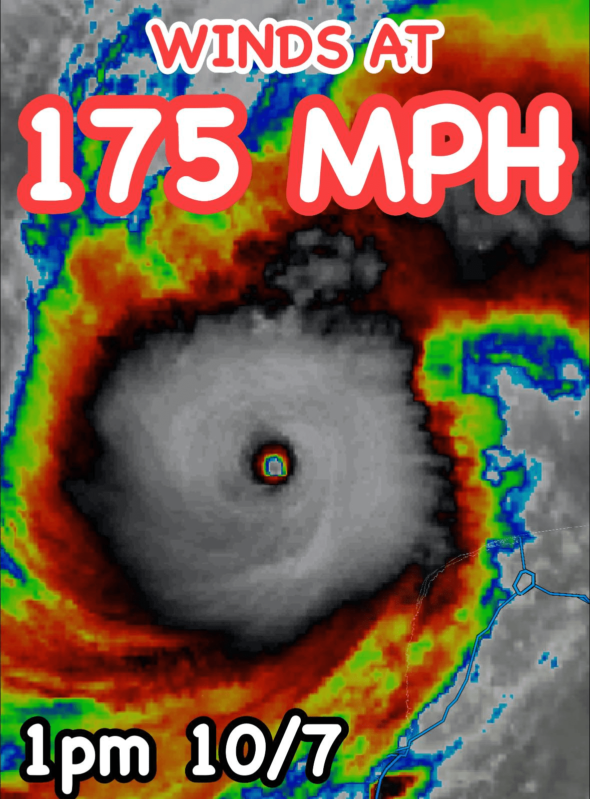
#Hurricane #Milton is shattering records in the Gulf of Mexico right now. It is WELL into Category 5 stage now with winds at 175mph. Central pressure is down to 911 millibars. This is the worst storm in the Gulf since Rita and Katrina in 2005. The Northern Yucatan Peninsula is going to have a very bad day.

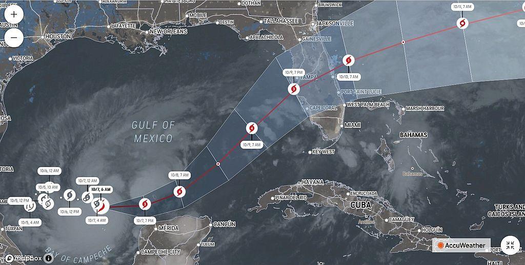
Milton is forecast to take an incredibly rare path. Since 1850, only two times has a tropical cyclone developed in the southwestern Gulf of Mexico and tracked toward Florida: Hurricane Eight (1859) and the Galveston Hurricane of 1867. Both of these were Category 1's; Milton is forecast to be a major hurricane at landfall on Wednesday.


INCREDIBLE INTENSIFICATION: A 'steady intensification' rate for a #hurricane is a pressure drop of one millibar per hour. #Milton has dropped NINE millibars in the past 60 minutes. That is at the upper echelon of recorded pressure drop rates in Atlantic-basin hurricanes (Wilma, 2005). It may become a Category 5 later today.​


1728325425588.png
 
Well, Milton, FL looks safe from Milton. 🤔
Family Ties
This is unfathomable!
🚨
#Hurricane #Milton is shattering records in the Gulf of Mexico right now. It is WELL into Category 5 stage now with winds at 175mph. Central pressure is down to 911 millibars. This is the worst storm in the Gulf since Rita and Katrina in 2005. The Northern Yucatan Peninsula is going to have a very bad day.

Milton is forecast to take an incredibly rare path. Since 1850, only two times has a tropical cyclone developed in the southwestern Gulf of Mexico and tracked toward Florida: Hurricane Eight (1859) and the Galveston Hurricane of 1867. Both of these were Category 1's; Milton is forecast to be a major hurricane at landfall on Wednesday.


INCREDIBLE INTENSIFICATION: A 'steady intensification' rate for a #hurricane is a pressure drop of one millibar per hour. #Milton has dropped NINE millibars in the past 60 minutes. That is at the upper echelon of recorded pressure drop rates in Atlantic-basin hurricanes (Wilma, 2005). It may become a Category 5 later today.


View attachment 55880
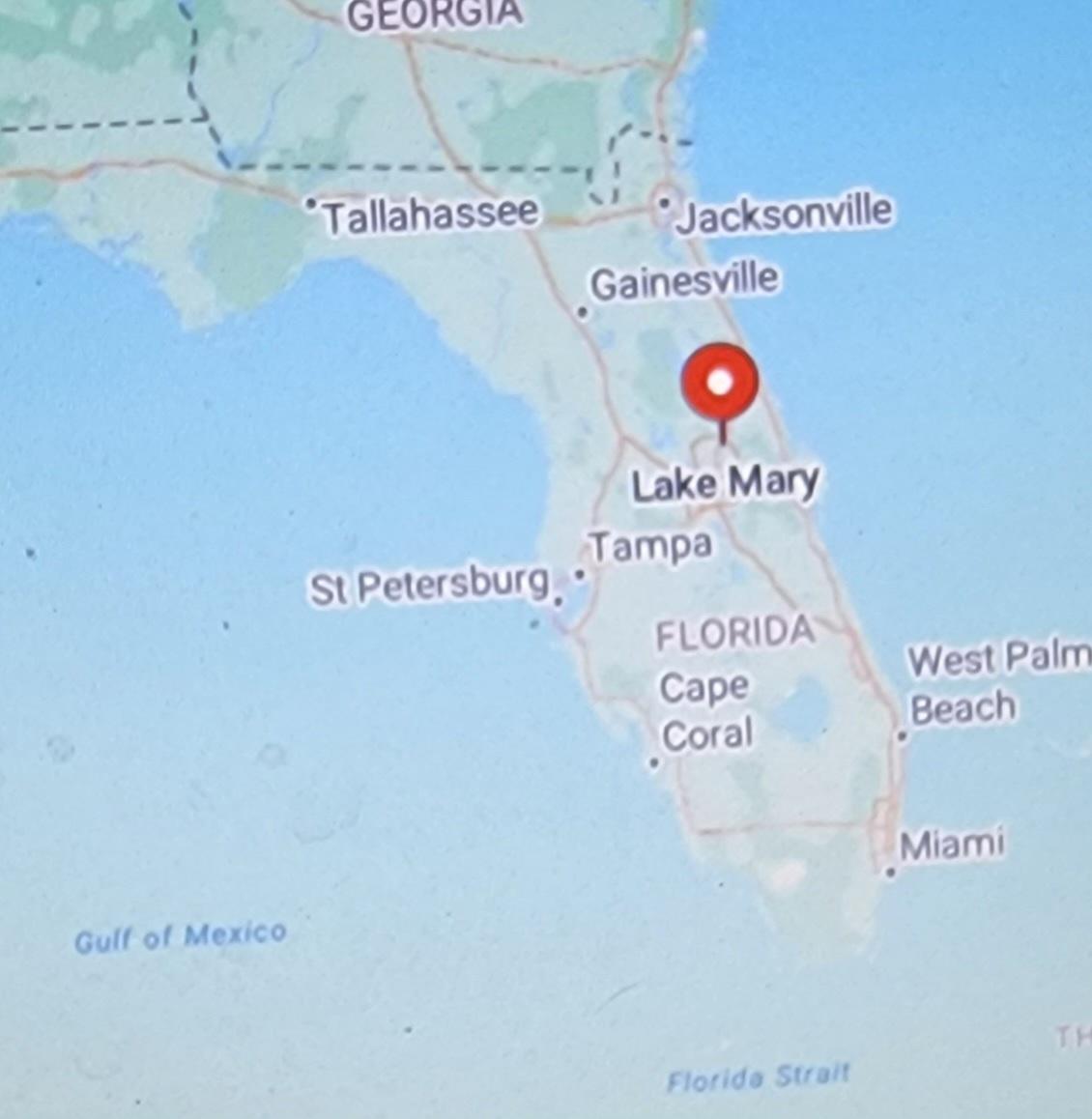
Slow speed over the warm gulf no wind shere. Recipe for disaster. My brother is in Lake Mary. Very concerned.
20241007_145512.jpg
 
Last edited:
My cousin lives in Tampa. Missed the last hurricane damage by a mile. Very stressful, the waiting...

I just talked to her. Matter of factly, she said this is not her first rodeo. They've got the shutters in place, she says her house is as hurricane resistant as possible, but they are headed to Virginia to ride this out.

Prayers for everybody in harms way.
 
Family Ties

Slow speed over the warm gulf no wind shere. Recipe for disaster. My brother is in Lake Mary. Very concerned.
View attachment 55882
Estimating 8-12 ft. storm surge ( +/- depending on the tide. High tide at 6am on the 10th) in the vicinity of Tampa Bay, with very large waves. And all this will be accompanied by spin up tornados before the eye even get's there.
 
Jim stated that the northern part of the Yucatan Peninsular is in for a bad day. I have driven across that area and there are poor locals in the small villages that live in almost cardboard boxes in many places. It will truly be tragic if it hits their areas.
 

Latest posts

Back
Top