Local pics after Helene

contender

Ruger Guru
Joined
Sep 18, 2002
Messages
31,459
City & State/Province
Lake Lure NC USA
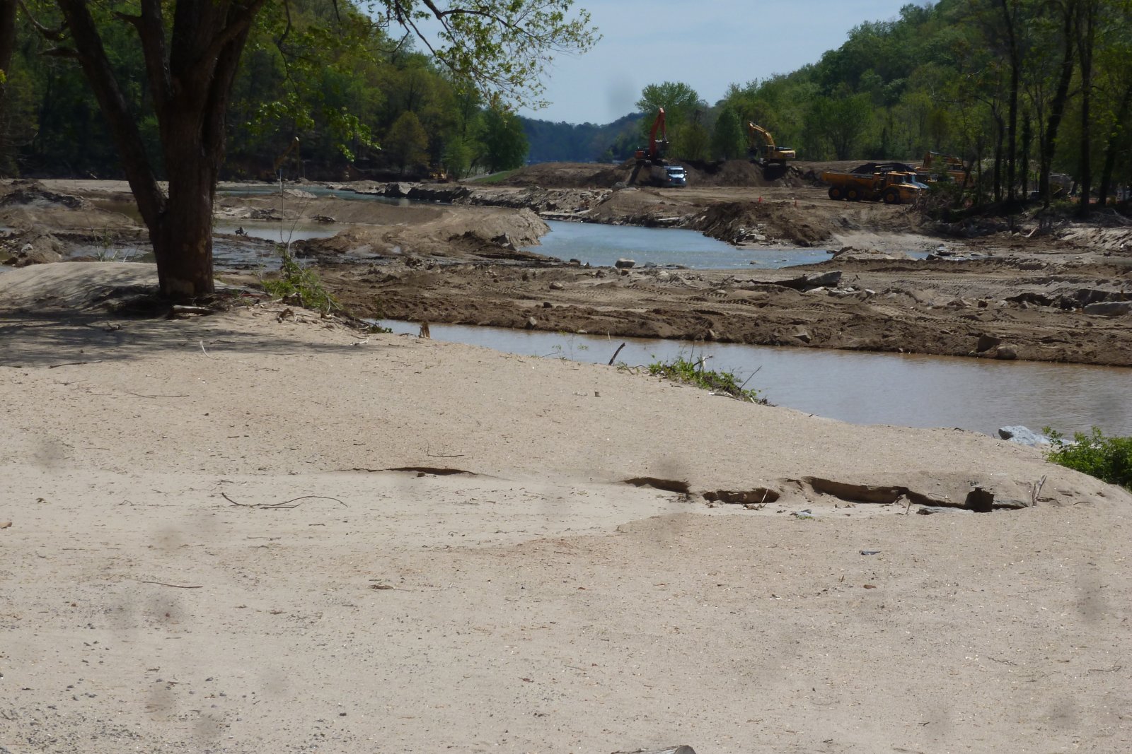
Ok,, I was able to get into & around the Chimney Rock, Bat Cave area this weekend & took a few pics. I mentioned I'd do that in my other post about the 6 months after. Here are just a few that offer a tiny view of just a little bit of the destruction, and even some of the work being done to fix it. Have patience,, I'll be loading several & that takes a little time for me.

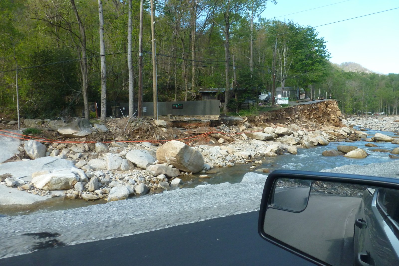
The first one is a picture of the west end of Chimney Rock Village, facing west,, with part of the rockwork where the gate entrance was. There USED to be (6) businesses from the rockwork west. All are gone.

The next one is about 1/4 mile away,, where Hickory Nut Falls Campground used to have a bridge, it's entrance, and even a house. That section of stuff is gone.

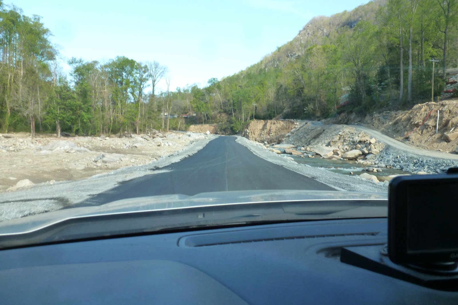
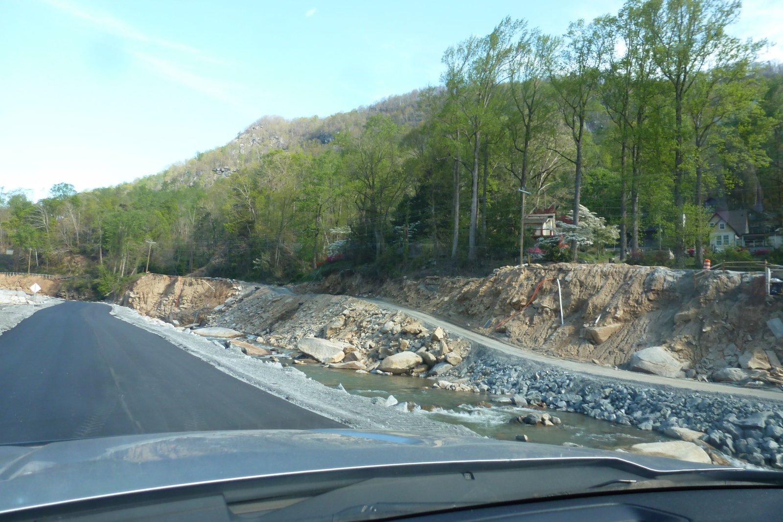
Next is a picture of us driving on the new, temporary road, down in the original riverbed,, with a section of the original road shown on the right side.
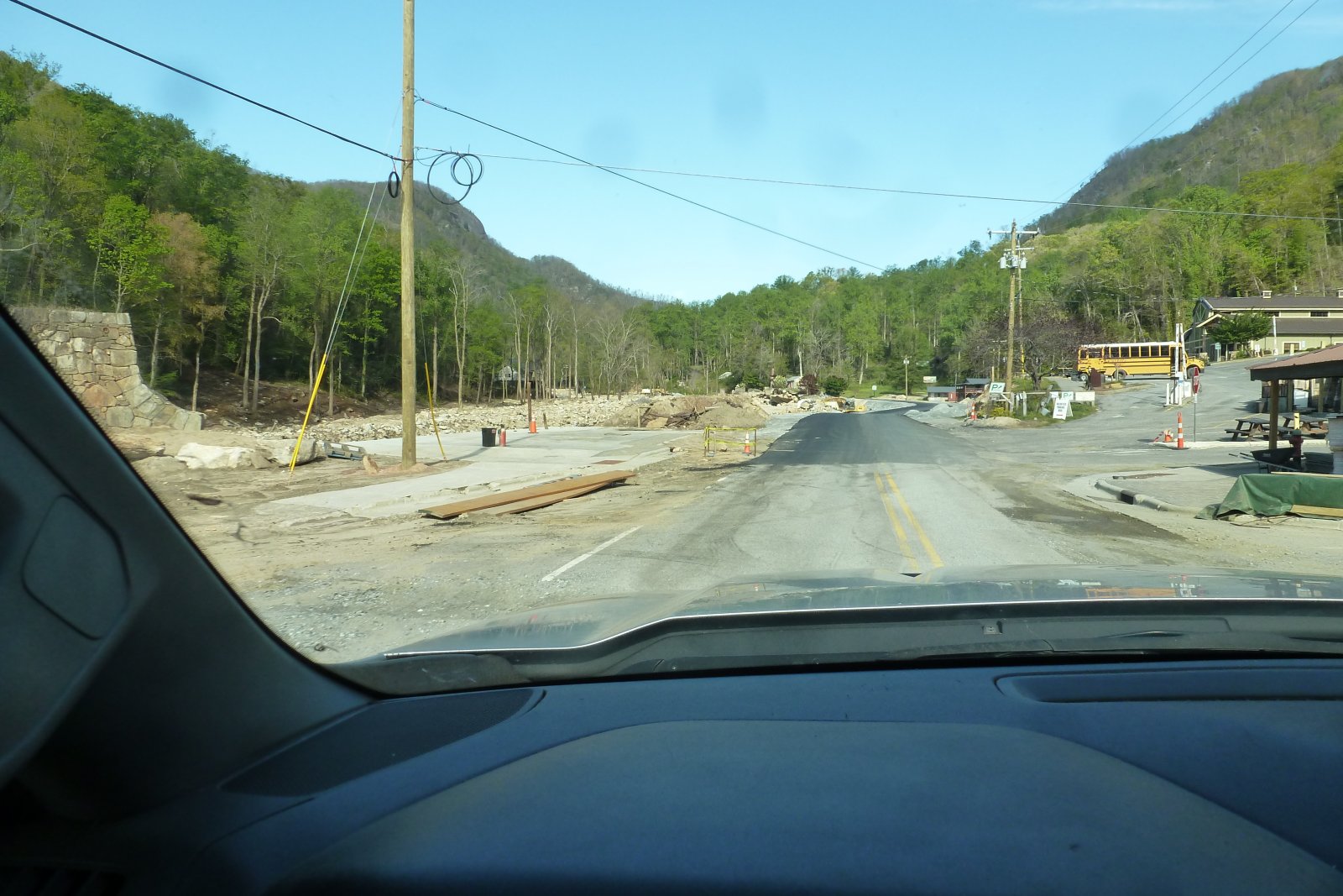
P1040541.JPG
P1040545.JPG
P1040548.JPG
 
For my next picture, similar to one above,, the higher portion is the original road, with a temporary gravel section that's used a little when they are working in the riverbed.

Next are different views
P1040549.JPG
P1040550.JPG
P1040551.JPG
of similar roadway stuff. Notice the height of the original road & how it's washed away. We are traveling in the riverbed.
 
Here's a picture of the temporary bridge coming out of the riverbed,, right at the east end of the entrance to a place called "The Esmeralda Inn. A historic place.

Just above the Esmeralda,, was a covered bridge,, leading to property across the river. This is what's left of the bridge support.

Next, just in Bat Cave,, a section showing where some houses & businesses used to be. I think there were 8-9 places there. All gone now. In the background,, the bridge where US-64 crosses the river. It's the road to & from Hendersonville NC.


P1040552.JPG
P1040556.JPG
P1040563.JPG
 
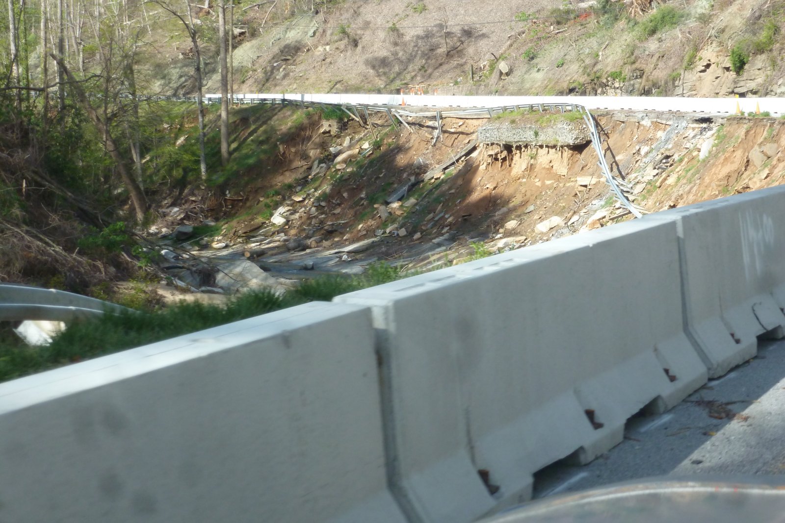
Going west on US-64,, just above the bridge,, (which BTW had a section gone, but has been repaired,) is a curve,, where the river washed away a large section, and included the loss of one lane.

Next is a picture of the same area as I'm headed east as we headed home.

And just below that curve & washout,, a one lane section, once again, showing the loss of part of US-64.

P1040566.JPG
P1040579.JPG
P1040582.JPG
 
Next,, I'll share some pics of various places where the rivers dumped all their silt, debris & such into the lake. The lake has been drawn down a bit to assist in the removal of silt & debris. But notice the way the level of the silt is in comparison to these boat houses. Normally the water depth has been from 8' to 15 ft or more in front of these boathouses.
P1040617.JPG
P1040623.JPG
P1040622.JPG


P1040615.JPG
 
Here are a couple of pics looking back towards the highway, the Lake Lure Marina, a dirt dam to allow work to be done, and a track hoe digging out silt. Part of the dirt dam is just fill in. And there's a creek that feeds into the lake at the beach area, (not visible here,) and it's coming around the dirt dam,, into the river that is the main feed for the lake. The river actually cuts across the area just below the track hoe and on down towards the rest of the lake.


P1040620.JPG
P1040621.JPG
 
Last few pics are of what's left of the "Flowering Bridge,, which used to be the main bridge, built after the 1916 flood. About 10 years ago,, the new bridge was built,, it's in the background, and it survived the flood.
Also shown is a picture of equipment trying to remove thousands of tons of silt & debris just below these bridges.


P1040625.JPG
P1040628.JPG
 
Wow, that's just crazy. Do you know what will happen to the businesses in Chimney Rock? I imagine they had insurance, I wonder how that is going for them? Listening to Blume's stories about the insurance company wanting to see the roof that isn't there makes you think.

Is the road drivable the length from Asheville up and over?

If you don't mind, i have a few pictures from 2019. Give me a few minutes.
 
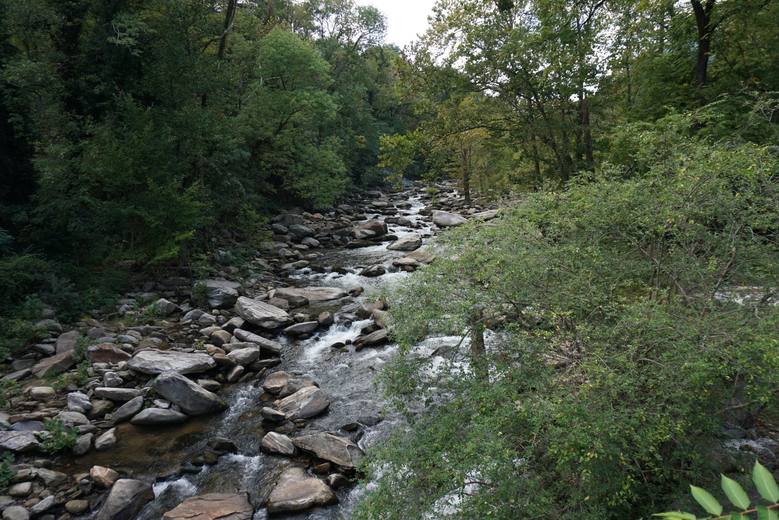
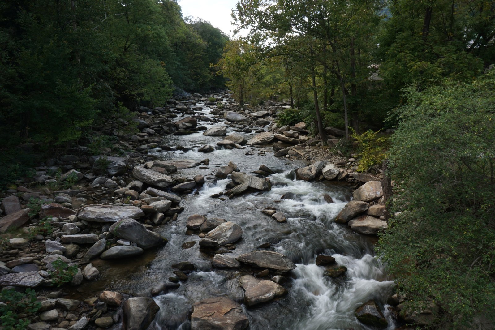
That river used to be so pretty with all those giant rocks.

ChimenyRockRiverSmaller.jpg


ChimneyRockRiver2smaller.jpg


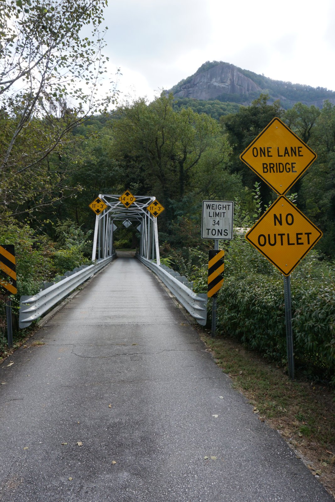
Contender, is this the bridge you are talking about?

ChimneyRockBridgesmaller.jpg


Here is the town of Chimney Rock from 2019.

ChimneyRocksmaller copy.jpg


ChimneyRock2smaller.jpg


ChimneyRock3Smaller.jpg


ChimenyRock4Smaller.jpg
 
Contender, thanks for posting all those pictures. Chimney Rock and Lake Lure are those cute little mountain towns that when you visit you could just feel like you could move there instantly. I've always loved little towns like that with all the tourists. It really hurts to see the pictures you posted.
 
I'm going to throw one picture in... I've been meaning to send my drone up to get a more recent one but in the mean time... here is what our house looked like about a week after Helene... this is after the 12 trees were removed... the top right part of the house also took major damage it is just hard to see.

DJI_0131.jpeg
 
Thanks for the pictures as we do not get news or pictures of that area in the Indianapolis TV stations.
 
Hey Blume! You’re sitting down in the upper right of that picture!

Were your dogs scared when that storm came through? Our dogs have never liked loud noises at all.
 
Hey Blume! You're sitting down in the upper right of that picture!

Were your dogs scared when that storm came through? Our dogs have never liked loud noises at all.
Yep, that's me looking at the monitor for the drone. One of my claims to fame is I actually have a pilots license with the FAA to fly drones commercially.
And the dogs were of course freaking out... My bathroom with tub and shower is down in the basement under the middle of the house and that is where Beauregard went.

IMG_8101.jpeg

This is from September 27th at 8:18 a.m. I use this more for storage in the Spring - Fall, I have an outside shower I use then.
the camo on in front of the boots to the left is actually my Tactical Kilt. maybe I'll wear it to the next East Coast meeting.....
 
Last edited:
Kevin's pictures are a lot of what the area looked like prior to Helene.

The river pics he showed, no longer look that way. Oh, there are PLENTY of rocks,, but that place he shows is MUCH wider, and a lot more exposed rocks.

That bridge he shows is not the one in my pics. It was a smaller bridge that allowed access to several houses across the river,, in Chimney Rock Village, about 500 yds below the Park entrance bridge. It's totally gone now. Those people across the river,, had several homes washed away or damaged. And for the others,, there is now a temporary bridge in place for them to access their property.

The pics he shows of the town of CR,, most of those buildings are still there. Most took some damage. Water flooded the streets, and into several of the businesses in those pics. I'll have to get some pics of the village to share so you can see the "after" of that section.

Blume's damages,, are a perfect example of the hundreds of similar damaged homes we have in our area.
 
A few days after the storm when news finally started getting out of the destruction that occurred through Lake Lure and up through the gorge, I stopped complaining about the damage I had. I didn't lose my life, my house, or my livelihood, a lot did.
 
Thanks for sharing the pics. The other day I was on Google Earth and went to street view in Chimney Rock. It was updated in November so you are able to see the damage done. Also looked at Lake Lure and you can see debris and building damage.
 
stunning, in a truly awful way. i grew up along US64 near Horse Shoe NC and lived there until college. all of these areas were our 'stomping grounds'.
i havent been back since 1988 [ work...medical practice , prevented me from doing much traveling ] severe [genetic] health problems will probably prevent me ever getting back there to visit. i am 77 now. glad i grew up there....wonderful country !

thanks !
 
johnp,, you are correct,, a LOT of people suffered a huge amount,, and sadly many are still suffering. The pics I showed of the destruction,, there were many, many houses just washed away completely. I've been trying to come up with a count of the houses & businesses that are completely gone, and so far,, I'm at 53. Yes,, 53 structures gone in just the Bat Cave to Lake Lure section. PLUS,,,,, there are at least 30 or more structures that are still partially there,, but have severe damage.

I took some video yesterday,, and tried to upload part of it last night. It said the video was too big. I may try again if I can figure out how to make it smaller.
As I drove through it again yesterday,,, due to repairs in a small section of the main original road,, they had us diverted into the riverbed,, on a section without pavement. I was driving over places I used to trout fish, looking up at the damaged buildings still standing above where I was.

hfcable,, if you grew up in Horse Shoe,,, you know the area enough to know the river there floods on a regular basis. I haven't traveled along that stretch yet,, but I've had enough folks who live there,, or who've traveled that to say that it too had a huge amount of flooding. What it didn't get was the amount of washing away completely that the Gorge got. But ONLY because of the fact the Horse Shoe area allowed the water to spread out more than the narrow Gorge we have here.
 
Brings tears to my eyes, such a beautiful area. I just can't imagine what those folks have/are going thru. Could the forum open up a go fund me for distribution?
 
Joey,, the gofundme is a nice gesture. However,, it'd be hard to know where to start,, and if it went to an "agency" I can assure you,, the people who truly are in need,, wouldn't get it. I'm seeing a lot of funds directed in places where the money SHOULD go to a different cause.
Examples;
Individuals who lost homes, and are still living in various temporary places. Yet,, the local governments are more concerned about a park, a brewerys, ballfields, or whatever instead of trying harder to actually get people into a home.
I see it all the time.

Plus,, the only companies doing the repairs around here have been "government approved" and not too many LOCAL people working on the damages.
We have crews from Utah, Texas & Florida doing 90% of the work.

The only good part is that even the local companies are working on private places & have plenty of work. But some people can't afford things and are still struggling.

In our area,, LUCKILY,, we only had (1) fatality,, and it was due to a lady who refused to evacuate. All the other buildings & businesses were not occupied during the flood. Most of the private houses were vacation homes. And it hit overnight,, while the businesses were closed.

So,, while we truly appreciate the gesture of a gofundme attitude,, I'm afraid the money wouldn't go where it's truly needed.
 
I would think if you did a little research you might could find a number of local churches that need and could use the money that are trying to help the locals out.
Just mail them a letter with the check.
 
Back
Top